Saturday, 25 February 2012

Snuffler, Free Software for Processing Geophysical Survey

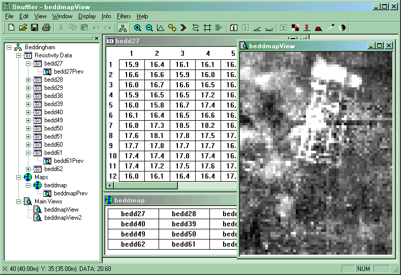
If you are working with geophysical survey data from the field school at home, you might care to have a look at Snuffler, a piece of completely free software for processing geophysical survey data.


In the words of its creator, "Snuffler can be used for any set of resistivity or magnetometry data in electronic or paper format, and most importantly it is FREE."


Its Current Features include:
  • Enter data from keyboard or text files
  • Import from RM15 & TR Systems resistivity meters, FM18/36 magnetometers, Arc-Geo logger, Bartington GRAD601 and EPE Resistivity Meter
  • Export of data to text files
  • Previews of data sets
  • Image view in Grey Scale, Dot Density and Relief
  • Display range clipping
  • Data and selection statistics
  • Printing of images with image info
  • Export of images to PNG (Portable Network Graphic) image files and VRML
  • Metadata Storage
  • Continuously sampled data processing
  • Filters, including :
    • Despike
    • Direct modification of data in a selection
    • Interpolation
    • Geological Flattening
    • Sharpen
    • Edge correction
    • Destripe
    • Clip Data
    • Destagger
Download Suffler as a zipped archive from here.

Tuesday, 21 February 2012

Visualizing Geophysical Survey

Two and three dimensional geophysical survey data need good visualization tools.  Golden Software's Surfer and Voxler products are two fine examples. Surfer provides tools for interpolation of continuous surfaces from sample data using a variety of interpolation tools and with a range of outputs from contours to 3D terrain models.


More interestingly, for working with 3D geophysical data such as time-sliced GPR, Voxler provides tools  for 3D interpolation of volumes and modeling and visualization using a variety of methods, including voxels (hence the name) volumetric models, etc.


Save disabled trial versions are free downloads, not time limited and provide an excellent way to get to grips with sophisticated modelling and visualization of geophysical survey data.